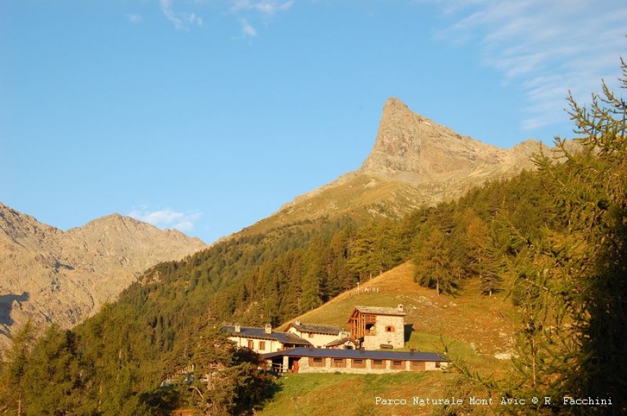
The Mont Avic nature park covers the area of approximately 5.800 hectares between the high alpine valleys of Champdepraz and Champorcher in the Italian region of Aosta Valley. Together with Gran Paradiso national park and Vanoise national park in France, it forms vast and one of the largest trans boundary protected areas in the Alps. Landscape types, which protection is rather poorly represented on the national level include high mountain ophiolite sites, mountain pine forests and peat bogs.
In the heart of the park there are many lakes that with its surroundings form a typical alpine landscape of great value.
The protected area preserves a wide variety of ecosystems and traditional agricultural activities, typical for alpine space. On high mountain pastures grazing cattle, and to a lesser extent sheep and goat is presented. In the early years of 20th century mining activities have gradually depleted forests.
In the last decades, the complete absence of economic exploitation of forests lead to its renewal. Consequently the presence of forest fauna improved (especially wood-eating insects, black woodpecker, boreal owl and Eurasian pygmy owl).
The role of protected area management
The park has acquired the labels SIC and ZPS, that safeguard habitats and species of particular interest. Among the most important ones we can mention the forest fauna, flora and fauna of less spread and therefore particularly vulnerable areas such as peat bogs and surfaces of serpentinite and schist rocks.
The Mont Avic nature park is the first protected area that obtained the label EMAS. European commission granted this certificate to the park in 2003. EMAS is an environment management system designed to encourage institutional, surveillance and other activities (especially agriculture and tourism) to undertake more appropriate environment treatment measures.
In order to promote proper visit to the park, more than 100 km of regularly maintained footpaths, accompanied with information panels and viewing points are arranged. In the visitor centre an interactive museum exhibition, devoted to habitats in the valley of Champdepraz is installed. A second visitor centre is currently in construction in the village of Champorcher, that will be design to present high altitude environments.
Park rangers and naturalist guides will provide guided and teaching visits. With nature conservation topics of internships, park welcomes students. On the web page www.montavic.it , you can find all further information, publications and full description of the park.
Park's identity card
|
Name of protected area |
Nature Park Mont Avic |
|
Managing enterprise (if different) |
|
|
Country |
Italy |
|
Area (ha) |
5 800 |
|
Year of creation |
1989 |
|
UICN category |
IV (SIC-ZPS) and VI |
|
Legal basis |
Governed by public law |
|
Included regions |
Autonomous Region Valle d'Aosta |
|
Number of municipalities |
2 (Champdepraz - Champorcher) |
|
Lowest point (m) |
1 000 |
|
Highest point (m) |
3 185 |
|
Population |
Not permanently inhabitated |
|
Forest surface |
1.560 ha |
|
Glacier surface |
20 ha |
|
Pasture surface |
400 ha (with alpine meadows included) |
|
Prevailing landscape types |
High altitude rock sites, alpine meadows, lakes, peat bogs, subalpine and alpine pastures, forests |
|
Emblematic fauna |
black grouse, black woodpecker and more than 1150 species of butterflies |
|
Emblematic flora |
mountain pine, peat, flora on serpentinite and schist |
|
Major touristic attractions |
Lake landscape with tree covered rocks, cultural and technical heritage of mining and pasture, panoramic sights on Graian and Penine Alps |
|
Information center(s) (quanitity, name, topics) |
Info centre of Covarey (featuring the Alpine Network of protected areas and the areas included in the Park) |
|
Internet site |
|
|
Number of employees |
17 (of which 4 part-time) |
|
Access |
Highway A5 exit Verrès, then use regional roads in direction for Champdepraz or Champorcher |


