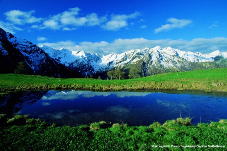
The Orobie Valtellinesi Regional Park extends on the northern side of the Orobic Alps, the first Alpine chain we meet climbing northwards up the lowlands of Lombardy and the Alpine foothills.
From a geomorphologic standpoint, the Park features a very complex landscape, characterized by fourteen ravines carved by the action of Quaternary glaciers and rushing streams.
Natural environment
The protected area features a typical mountain environment, with broadleaf forests, dominated by the chestnut spread by men in the past, and coniferous forests where the Norway spruce prevails, along with the European silver fir and the larch. Across a transition area marked by misshapen shrubs, we reach the Alpine meadow, exploited for centuries for livestock grazing. At higher altitudes, rocky and periglacial environments are home to plant species that specialise in surviving in extreme conditions.
This is also a biodiversity-rich landscape, as witnessed by the presence of rare and protected species, 3 of which are endemic to the area: the Viola Comollia, a rare species found in high altitude scree habitats, the Sanguisorba dodecandra, abundant in wet valleys, and the Androsace brevis, typically found on mountain ridges.
A rich faunistic heritage
The valleys on the Valtellina side of the Orobic Alps harbour an extremely rich faunistic heritage. The presence of the capercaillie, symbol of the park, testifies to the degree of naturalness of the park. The many different species living in the park include the black woodpecker, the Eurasian eagle-owl, the Eurasian pigmy owl, the golden eagle, the ermine, the rock ptarmigan, and the rare alpine salamander.
A wealth of history, art and ethnography
The Orobie Valtellinesi, characterized by inaccessible valleys and an unfavourable exposure, still remain relatively untouched by mass tourism, therefore representing a real and true treasure chest of historical, artistic and ethnographic records. Signs of ancient works, such as the remains of irons ores, melting furnaces and mills, are still visible. It is also possible to find traditional milk processing plants, called calècc, still in use today. The area abounds with evidence of popular religious customs and remains of the road system, such as the Strada Priula built for the transportation of goods. From the few traces of the first men venturing into the park valleys to the fortifications built during the Great War, History has left its mark.
The role of the Park Authority
The Park Authority has administrative tasks concerning forestry, hydrogeology, environment, and landscape matters, as well as the duty to promote and disseminate education and tourist activities aimed at safeguarding and enhancing the natural, cultural, and human heritage of the area.
The managing authority has always focused on research and land conservation activities, developing throughout the years several projects aimed at safeguarding particularly sensitive habitats and experimenting new forms of agricultural management.
Park's identity card
|
Name of the protected area |
Orobie Valtellinesi Regional Park |
|
Country |
Italy |
|
Area (ha) |
44100 |
|
Year of creation |
1989 |
|
UICN category |
V - Protected Landscape/Seascape |
|
Legal basis |
Regional Park |
|
Included regions |
Lombardy |
|
Number of municipalities |
25 |
|
Highest point (m) |
3052 |
|
Lowest point (m) |
850 |
|
Population |
uninhabited (only temporarily inhabited during summer) |
|
Forest surface |
23224,95 ha |
|
Glacier surface |
8381,47 ha |
|
Pasture surface |
143 ha |
|
Prevailing landscape types |
"Broadleaf and coniferous forests Rock and scree habitats Alpine grasslands" |
|
Emblematic fauna |
Capercaillie, ibex, chamois, golden eagle, Eurasian eagle-owl, rock ptarmigan, black woodpecker, boreal owl, Eurasian pygmy owl, alpine salamander |
|
Emblematic flora |
Viola comollia, Sanguisorba dodecandra, Androsace brevis |
|
Major touristic attractions |
Old historical, artistic and ethnographic records (fortifications of the First World War, remains of melting furnaces and agricultural buildings, transit routes for goods transportation, such as the Strada Priula); Giant's kettles; GVO (Gran Via delle Orobie) hiking route. |
|
Information center(s) (quanitity, name, topics) |
- “La casa del Tempo e sentieri attrezzati” |
|
Website |
|
|
Number of employees |
6 (of which 4 work part-time) |
|
Nearest alpine protected area |
Orobie Bergamasche Regional Park |


