Le Réseau Alpin des Espaces Protégés
The ALPARC (Alpine Network of Protected Areas) Large carnivores working group was created during the ALPARC Conference in Belluno in 1999. Over the course of various thematic meetings, the group has taken shape, defining objectives and practical activities to be undertaken.
The group has worked incredibly hard, notably on preserving large carnivores in the Alps; providing accurate biological and demographic information about bears, wolves and lynx; investigating strategies that can promote the social, economic and cultural conditions that will allow humans and these three species to coexist; experimenting with solutions that can be used to resolve conflicts, and establishing a cooperation network with other organisations and associations.
In order to achieve its aims, the working group has appointed the Adamello Brenta Nature Park as lead partner and has defined specific activities designed to foster constructive partnerships whilst also engaging in awareness-raising activities, ongoing species monitoring and the development of a common conservation strategy for each species.
Up to now, the working group's activities have not been as effective as we had hoped, largely due to the fact that very few Alpine protected areas have been involved in the activities suggested by the Adamello Brenta Nature Park and by the Task Force Protected Areas, which coordinates ALPARC's activities.
Consequently, at the meeting held in Mittersill (Hohe Tauern National Park, Austria) in 2009 during the Danilo Re Memorial , a decision was taken to send out a questionnaire to all Alpine protected areas with a view to establishing the level of interest in the Large carnivores working group, reviewing its role and considering how it could be developed.
The questionnaire was designed by the Adamello Brenta Nature Park in consultation with the Task Force Protected Areas. It also sought to identify the conservation activities undertaken by Alpine protected areas in relation to bears, wolves and lynx.
Although we sent out a total of 211 questionnaires to the managers of nearly all protected areas, we only received 15 responses.The questionnaire's primary aim was to establish whether protected areas were or might be interested in contributing to the activities of the Large carnivores working group. The poor response rate gives a clear signal about how much effort and activity is devoted to the issue on the ground.
The information obtained from the questionnaires does not appear to be representative and is therefore not deemed to provide a useful overview of the current and planned activities within the protected areas in relation to large carnivore conservation in the Alps. However, some interesting avenues for exploration have emerged, not least across-the-board demand for greater cooperation between protected areas.
More specifically, 14 of the 15 protected areas who returned the questionnaire stressed the need to establish cooperation and to pool specific and up-to-date information with a view to defining a common conservation strategy for the bear, wolf and lynx populations. In addition, the responses highlighted the lack of trans-Alpine cooperation on large carnivores plus the need to agree on objectives and content that could be more effective if undertaken as a shared initiative. The protected areas suggested that a protocol was required in order to standardise monitoring methods and use of monitoring data. Lastly, the protected areas flagged up the need to create ecological corridors between protected areas and to facilitate exchanges of information and good practice, particularly on the subject of minimising social conflict linked to human production activities.
Source: Adamello Brenta Nature Park et ALPARC (Alpine Network of Protected Areas)
Filippo Zibordi
Parco Naturale Adamello Brenta
Tracking knowledge on ecological connectivity in the Alps: the 50 most important questions on ecological connectivity in Alps have just been identified
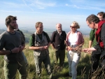
It was in Liestal, Switzerland, that a group of 20 scientists and practitioners from all alpine countries and different specialties met the 6th and 7th December in order to define together the 50 most important questions on ecological connectivity in the Alps.
This project, which is based on a methodological approach developed by the British scientist Bill Sutherland and has been applied various times on topics related to biodiversity by himself, is led by professor Chris Walzer from the University of Vienna (A), Econnect leadpartner, and has already begun last summer.
More than 150 persons from the 8 alpine countries and different fields of work were invited to submit their proposals for possible questions on this topic. At the end, the 50 most interesting questions among the 500 questions received were selected using scientific criteria. The questions that were defined cover a large number of different topics with a certain focus on questions linked to climate change.
The final list of questions will soon be published in an international peer reviewed journal and also be communicated to a broader public. In the future, this catalog of questions should serve as an orientation to scientists working on this topic as well as to governmental institutions and other potential funder when developing projects or deciding about the attribution of financial support.
In 2009 the ALPARC “Joint Communication and Environmental Education ” working group initiated the project to create a new and attractive joint communication tool for the visitor centres of the protected areas. This project can at last become reality in 2011 thanks to the financial and concrete investment (several hundred images) by 20 protected areas managers and equally thanks to the financial support of the German Ministry of the Environment .
20 managers or representatives of almost 60 protected areas of the various Alpine countries are united around this fine project which will make available to all the protected areas a simple but fascinating tool to present the protected areas to the general public.
|
The official partners of the project: |
|||||
|
Nationalpark Hohe Tauern |
A |
Nationalpark Berchtesgaden |
D |
Parco Naturale Alta Valsesia |
I |
|
Nationalpark Gesäuse * |
A |
ASTERS - Réserves naturelles de Haute-Savoie |
F |
Parco Naturale del Monte Fenera |
I |
|
Nationalpark Kalkalpen |
A |
Parc national de la Vanoise |
F |
Parco Nazionale Val Grande |
I |
|
Landschaftspark Binntal |
CH |
Parc national des Ecrins * |
F |
Parco Regionale delle Orobie Valtellinesi |
I |
|
Naturpark Pfyn-Finges |
CH |
Parc national du Mercantour |
F |
Parco dell'Adamello |
I |
|
Netzwerk Schweizer Pärke * |
CH |
Amt für Naturparke Südtirol / Ufficio Parchi naturali Alto Adige * |
I |
Triglavski narodni park * |
S |
|
Parc Naziunal Svizzer |
CH |
Ente di gestione delle aree protette dell'Ossola (Parco naturale Alpe Veglia Alpe Devero & Parco naturale dell'alta Valle Antrona) * |
I |
TFPA / ALPARC * |
|
* Members of the project steering committee
Multivision is a top-quality audiovisual experience, a carefully-crafted story featuring impressive scenery and instantly-recognizable elements. A wide-screen presentation with multiple images fading in and out, set to music, more like a stylish slide show than a film. Using stills will allow us to create displays and combinations that convey simple messages, primarily through vision and sound. There are just a few key personal stories included to enhance the experience.
Difficult to describe in words, multivision is appreciated by the eyes and ears: an extract (3 min.) of the multivision of Les Ecrins National Park/F can be seen onlineat this link

From the outset this project was stamped with the will to be exemplary... the Park House, situated in the village of La Chapelle-en-Valgaudemar has just been awarded the “Tourism and Disability” label for these four types of disability: motor, sight, hearing and mental, to the delight of the entire team who had devoted their energies to this end and who now see their efforts rewarded.
Judge for yourselves: reserved parking spaces, moving walkway access to reception and tactile ramp, tactile model of the whole building , adapted facilities inside the building, access ramps and ramps to visit temporary exhibitions, guide strips on the floor, audio guides, adapted reception furniture, reserved seats in the audiovisual space...
All the single storey exhibition space has been designed to be accessible to all and to cater for all types of visitors in a recreational way.
Coherent welcoming facilities for disabled people now have to be taken further by working towards the creation of a natural site which can be experienced by these visitors with their infectious enthusiasm. Training in welcoming the disabled is also on the agenda.
|
Adapted reception facilities, tactile model, audio guides... are some of the accessories adapted for disabled visitors to the Park House. |
Source: Parc national des Ecrins press release, complete original version at this link (in French only)
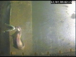
Otters continue to astonish the scientific community. For decades, the otter was on the brink of extinction but the population is now growing rapidly without any human assistance. Sightings of the mammals, which are part of the weasel family (Mustelidae), are becoming more common throughout the Alps, particularly in Austria, France, Germany and Switzerland.
The species was seriously endangered in the 19th century, when otters were hunted down both for their fur and because they were believed to be rapacious predators of fish. A ban on hunting otters failed to halt the population's decline, which was primarily caused by damage to their natural habitat.
Up to now, otters were believed to have survived in a only few places: the Inn and Ziller rivers (Tyrol, Austria), in the Fecht (Alsace, France) and in the Ticino river (Lombardy, Italy) following a reintroduction programme.
However, in recent years otters from the Laming valley (Styria, Austria) have moved further afield, with sightings reported around the Swiss Domat hydroelectric plant since December 2009. Other sightings have been recorded in recent months in the Rhone-Alps region in France – close to the Monts d'Ardèche Regional Nature Park and the Ile de la Platière Nature Reserve.
This is definitely good news, news which gives us reason to hope that otters will gradually return to populate the whole of the Alpine massif.
Sources:
NZZ online (German)
Office for hunting and fishing of the Graubünden (German, Italian and Romansh)
Association pro lutra (German and French)
Rheinaubund (German)
3 sat (German)
Spiegel online (German)
Enviscope (French)
ledauphine.com (French)
Corriere della sera.it (Italian)
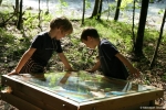
That is the opening line of the pocket-sized brochure produced for the new educational trail through the glacier foreland in the Lötschental (Switzerland), but applies equally to the recently opened Wilde John educational walking trail in the Hohe Tauern National Park in Austria. Both trails are designed to educate visitors about changes in the landscape, both naturally occurring and those caused by human activity, with the information being conveyed in very different ways and targeting different age groups.
The "Wilde John " path is aimed at young visitors; it teaches through a tale the history of the ‘Johnsbach’. In this tale the mountain stream ‘Johnsbach’ is represented by the Giant John. Visitors follow the stream from its wild and untrammelled youth through being straightened out and tamed between 1950 and 1975, then returned to its natural course as part of a LIFE project and freed from its restraints. The various interactive stations along the course of the stream allow children for example to discover what John is thinking and also provide information about other story-based LIFE project venues in Austria.
The 23 information points on the thematic educational trail on climate and glacier areas explain how the glacier forelands around the Lang Glacier have developed and teach visitors about how glaciers shape the landscape. There are an accompanying free leaflet and booklet available. Each information station includes a QR code that can be used in conjunction with certain mobile phones to view the website which contains information about each station.
The walking trail therefore provides both scientific and recreational information. There are a number of routes to choose from: it takes around 5 hours to visit all 23 information stations. For summer 2011, the edition of a scientific book as well as some worksheets for secondary and high school classes are planned.
Link(s) :
From 20th to 23rd September 2010 an international exchange meeting between experts on ecological connectivity from the Alps and the Carpathians was held in Mikulov (CZ). This meeting was organised in the frame of the Memorandum of Cooperation signed in 2008 between the Convention on biological diversity (CBD), the Alpine and the Carpathian Convention.
During these packed but nevertheless very convivial days, the participants had the occasion to visit the Alps-Carpathian-Corridor project , aiming at facilitate migration of large mammals between the two mountain ranges.
The following day was dedicated to the 6th official meeting of the Platform “Ecological network” of the Alpine Convention . In parallel a meeting with representatives from the Carpathians was held, in order to discuss the creation of a similar working group in the frame of the Carpathian Convention. The international conference itself was held on Wednesday, offering numerous presentations of concrete best practice examples and working experiences from both mountain areas. There was also enough room for discussions, one of the main aims of this meeting being the definition of future cooperation projects on this specific topic.
The meeting was closed with an excursion to the Pavla protected area nearby, with an introduction to local problems concerning ecological connectivity but at the same time offering also the possibility to further deepen the exchange between the participants in a more informal frame.
All in all, these days have permitted to set the bases for future cooperation projects and represent a further step to strengthen the good exchange between the two mountain ranges on a topic that is of particular importance for nature protection in the future.
“The first time I took part in exchanges with the REEMA was at the workshop organised in Zernez during the Alparc meeting. I saw men and women responsible for education on the environment in the protected areas of the Alpine massif. They were gathered around a table and on that table, in pride of place, was an egg.
They spoke about how we need to overcome the fears and apprehensions related to nature by drawing on knowledge and positive feelings; at that point the shell began to crack. Despite language barriers they showed their desire to share their experiences and, as they opened their arms, the bird spread its wings and began to fly. Disregarding borders, it started its journey through the Alpine range, towards that which unites men and shapes the Alpine identity. If you see that bird in the Alpine skies, tell yourself that its journey has hardly begun and that each of us has the choice of deciding whether to follow it or not”...
Frank Miramand, ASTERS - Conservatory of Natural Areas of Haute-Savoie.
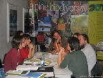
Several people responsible for education about the environment in the various protected areas in the Alps had the opportunity of meeting for the first time for a workshop dedicated to the theme of their work on 19 and 20 October 2010 alongside the ALPARC General Assembly in the Swiss National Park .
Inscriptions poured in – proof of how important and topical this theme is- and unfortunately some delegates had to be refused (except for protected areas).
Finally 26 people looked into their profession and the possibilities for cooperation on an Alpine scale. The meeting was co-organised with the Reema (Alpine Network for Education about the Mountain Environment), which brings together those responsible for environmental education in the French Alpine protected areas. The other Alpine countries were equally well-represented so that 1/3 of the participants were French, 1/3 Italian and 1/3 German-speaking (Germany, Austria, Switzerland). Most importantly, they were all very motivated!
Apart from the primary objective of meeting opposite numbers from other Alpine parks or reserves in order to exchange thoughts about their profession and their experiences, the aim of the meeting was to define together ideas on common actions and projects. The working group thus constituted confirmed its wish to begin collaboration on this theme on an Alpine scale within the framework of ALPARC.
The meeting made it possible to list various working directions and several ideas for actions or more developed projects: participation in the Phénoclim programme , setting up of common teaching tools, pooling of resources, think tanks on educational values ( Alpine identities, mountain culture …), work on the assessment of educational initiatives but also on the recognition of the educational mission inside the parks, etc…
It now remains to define priorities and a working schedule for the group who are notably going to use a collaboration space online which is in the process of being set up.
These exchanges revealed the feeling that there is a lack of consideration for the educational mission inside the protected areas (in most of the countries represented) in comparison with other missions such as research or scientific monitoring. This is often expressed by a lack of human and financial means.
It has become apparent, however, that education about the mountain environment is one of the essential missions of the Alpine protected areas. This is because enabling their inhabitants and visitors, young and old, to discover, feel and experience the mountains and Alpine nature (“educating through the heart and emotions”), is a vital first step towards the respect of this environment! The delegates therefore wished to give a reminder that environment education is a real tool in the protection of nature.
If you are responsible for environmental education in an Alpine protected area, but were not present at this meeting, you can of course join the working group for the continuation of the work: contact marie.stoeckel@alparc.org
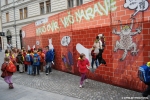
The Ecological Continuum Initiative has developed a very unusual communication tool: a large wall that can easily be set up in a public space or a pedestrian zone to restrict access. The barrier illustrates the difficulties that roads and conurbations create for wildlife by cutting off their migratory routes.
The wall contains animal-shaped blank sections and displays information on how natural habitats are being linked up in networks. In October 2010, as part of the International Year of Biodiversity, six walls were erected at the same time in six major Alpine towns and attracted a lot of media attention.
Are you planning an event to focus attention on the fragmentation of natural habitats? If so, why not make use of one of the six walls, free of charge, during the event? Information brochures suitable for handing out to passers-by are also available.
For more information and to obtain a paper copy of the information brochures, contact Mateja Pirc .
Stop – no way through! A giant wall blocks the way of pedestrians in Zurich/CH, Vienna/A, Munich/D, Ljubljana/SI, Milan/I and Lyon/F. For animals, it’s the same every day: streets and settlements increasingly fragment their migration routes.
Against the background of the 10th Meeting of the Conference of the Parties of the Convention on Biodiversity, being held in Nagoya, Japan in the second half of October, the ‘Ecological Continuum Initiative’ demonstrated with ‘The Wall’ on 20 October how important interlinked habitats are for the survival of many plant and animal species.
Take a look at some media reports from the different countries at this link: www.alpine-ecological-network.org
Source: press release by Cipra International, in the frame of the Ecological Continuum, gathering CIPRA, ALPARC, WWF and ISCAR
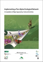
A new report “Implementing a Pan-Alpine Ecological Network - A Compilation of Major Approaches, Tools and Activities” on the alpine activities on ecological connectivity over the past years has been published in the series “BfN Skripten” of the German Federal Agency of Nature Protection.
During the last few years various documents, publications and reports which reflect approaches, tools and activities that support the implementation of an ecological network across the Alps have been published. Some of this information had not been made available for a wide public until now. Others exist only as comprehensive independent publications. Therefore these activities and results have now been compiled and summarised by the Ecological Continuum Initiative in the report “Implementing a Pan-Alpine Ecological Network - A Compilation of Major Approaches, Tools and Activities”.
This new report is available in English language. It is available for download here . You can order your free copy writing to kerstin.lehmann@bfn.de
The second international meeting of the pilot regions which proceeded in Dobbiaco/Toblach on April 22, 2010 bore its fruits. Indeed, the pilot regions adopted a common tool, entitled JECAMI (Joint Ecological Continuum Analysing and Mapping Initiative-Web services).
This instrument is proposed by the Swiss National Park in collaboration with the Arinas company;
The benefits of this initiative are numerous, indeed, it will make it possible the Pilot regions to apply a strategy harmonized in order to analyze the situation of ecological connectivity.
The pilot regions will be able to identify the ideal and priority surface to establish future measures of connectivity, then to make use of it like support of communication on Internet for the various users, and authorities.
This easily accessible tool will bring a visibility of connectivity. It will be possible to visualize at the same time the habitats of the species and the results of connectivity.
Econnect awaited an effective tool to incorporate and to combine the space results of the project and a facilitated access of all the stakeholders concerned, it’s done!
Ruedi Haller from the Swiss National Park presents the cartographic tool JECAMI
http://www.alparc.org/the-alparc-network/a-spatial-network/project-econnect
